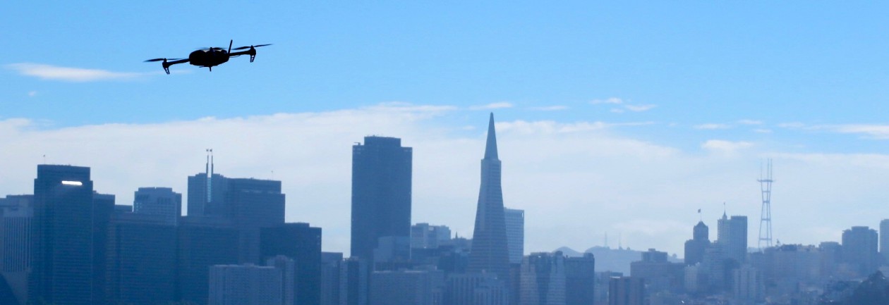
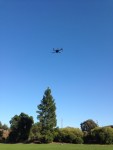
A month ago, I posted about an innovative new approach to the design of fixed-wing drones. When I first saw the JUMP, by Arcturus, I was blown away at how such a simple idea could revolutionize the sUAS industry. By combining the vertical-take-off-and-landing (VTOL) capabilities of a multi-rotor with a fixed-wing platform, the failures associated with a conventional “crash-landing” are essentially eliminated.
Lo and behold, it only took a few weeks for me to start and seeing other hybrid systems already on the market. Birds Eye View Aerobotics’ FireFly6 stood out to me because of it’s simplistic design and economical price (about 800 bucks for everything). Check out the video to see how cool this drone is!
So is this new approach going to be adopted throughout the UAS industry? It will be interesting to check back in a year to gauge how many hybrid systems are out there. Considering the pace of progress, and the willingness of UAV manufactures to embrace new ideas, I would say absolutely.
I wanted to pass along an exciting event hosted by the American Society of Photogrammetry and Remote Sensing (ASPRS) Northern California Region! The UAS Technical Demonstration and Symposium will take place October 21-22 in Reno, Nevada. An abstract of the event is below:
The ASPRS Northern California Region is hosting a 2-day symposium on unmanned aircraft systems (UAS) in Reno, NV on October 21-22, 2014. The purpose of the event is to assemble academia, UAS developers, survey and mapping companies, government agencies, and UAS enthusiasts, to share information, showcase new technologies and demonstrate UAS systems in action (in flight). The event will be held at the Reno Stead Airport, an FAA-designated UAS test site, as well as at a symposium hotel in downtown Reno. The mission of the event is to advance knowledge and improve the understanding of UAS technologies and their safe and efficient introduction into our national airspace, government programs and business.
Information about the symposium and ASPRS can be found attheir website, or you can contact me and I will point you in the right direction.
No matter the scale, flight planning has always been key to any successful aerial photogrammetry/remote sensing project. The rules for UAS are no different. Additionally, a successful flight plan is characterized by knowing the specifications of the camera/sensor and having a UAS that is capable of flying with that sensor mounted.
Part of the planning process involves defining a number of specifications for the desired end-product before going into the field. Some basic considerations include:
Image resolution: How much detail is desired? A smaller ground sample distance (GSD or pixel resolution) will have a higher resolution compared to a larger one. The flying height and focal length of a cameras sensor determine the pixel resolution.
Image overlap and sidelap: Image overlap and sidelap are essential for the establishment of tie points that orient the images and create the 3D model. Traditional standards call for 60% overlap and 30% sidelap, however, UAS acquisition usually requires higher variations of both.
Sun angle and weather: Reducing the amount of shadows is very important when capturing aerial imagery. Having the sun at it’s peak height in the sky minimizes shadows and allows the sensor to receive as much light as possible. Wind also plays an important factor. How powerful is your UAS? How powerful of wind gusts can in handle and still maintain a level position?
So you are ready to make a successful flight and have all of the flight planning figured out. The next question, however, is how geographically accurate should it be? If one is only interested in a product that is marginally accurate, say within 5-10 meters, than the GPS from the flight log file or camera would be sufficient.
For survey grade accuracy however, having a set of survey control points measured from a professional land surveyor is necessary. Control points are the most accurate way to ground truth any georeferenced product. Land surveying is expensive, however, so a product with an accuracy within 5-10 meters may be enough for some.
Software
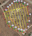
AOI in Red and Flight Lines in Yellow
For flight planning, I use Mission Planner, sponsored by 3D Robotics. It is free to download and very easy to use. I have an ideal ground station by combining this software and the supplied telemetry antennas that came with the 3DR IRIS. With a few simple clicks, Mission Planner is able to display flight data in real-time through a series of interchangeable gauges.
The Flight Plan tool allows the user to plan varies autonomous missions and tasks by establishing GPS waypoints. For my project, I used the survey (grid) tool. Within minutes I had my area of interest (AOI) polygon, entered my camera specifications (the iPhone 5s’ focal length is 4.12 mm) and set my overlap and sidelap (70 and 60 percent).
On top of flight planning, Mission Planner also acts as the control station for the IRIS. By using the supplied telemetry kit, my laptop was able to send and receive data in real-time to the copter. A log file was also recorded storing all of the flight parameters.
Imagery Acquisition
The desired pixel resolution for this project was 1 cm. Considering the highest resolution from traditional manned aircraft missions averages between
Image Courtesy of CameraSharp
1-3 inches, resolution to this degree from a consumer grade product like an iPhone is quite remarkable.
During the flight, the camera shutter was activated using an intervalometer feature from an app called CameraSharp. The app allows you to set the seconds interval at which you wish to snap photos. For this project, I went with one photo every second. I have yet to determine the exact amount of overlap I averaged, but considering the flying speed of the IRIS was well below the necessary limit for 70%, I’m guessing I achieved an overlap somewhere in the 75-80% range. I’ll post those results in a few months when my research is complete.
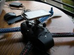
iPhone 5s and Flight Specs
The flying height was set at 28 m to obtain a pixel resolution slightly better than 1 cm at the sites lowest point. The figure to the right illustrates the iPhone 5s and flight specifications.
Ground Control
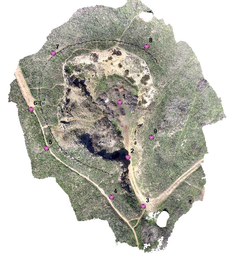
Having a professional land surveyor measure ground control points (GCPs) is the best way to accurately ground truth any geospatial data. Thankfully, I have some friends who had experience and equipment to measure GCPs for me at the Lime Ridge site. The control was measured using a Trimble real time kinematic (RTK) device. The RTK provides real-time corrections of GPS information by way of a network base station enabling the measurements to be accurate with 1 cm.
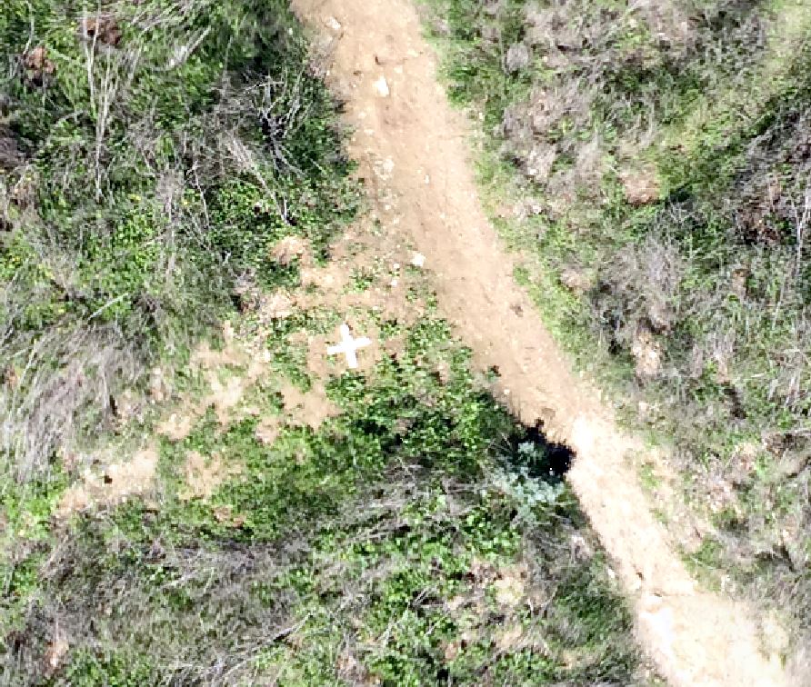
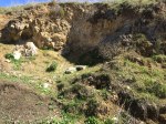
Aerial Target 5
Aerial targets were fabricated using some poster board that were cut 5 cm wide at the edges. Nine targets were placed around the site providing a sufficient ground truth throughout. The targets were measured during image processing.
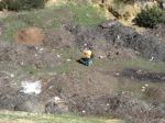
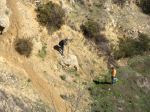
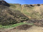
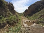
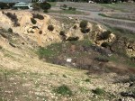
The site I chose for my project was an area of the Lime Ridge Open Space in Concord, CA. In the late 19th and early 20th centuries, limestone was mined in this area for cement production leaving behind a number of quarry ruins. Digging stopped in 1946, and in 1974, the land was purchased through a bond measure. It is 2nd largest open space in CA.
There are two large areas of the open space separated by Ygnacio Valley Rd. This project site is just north of Treat blvd. The terrain is perfect for showcasing topography while still being small enough to acquire imagery in one flight.
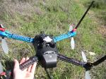
The sUAS market is blossoming at an exceptionally swift pace. Being that I did not have a hobbiest background before starting this project, I wanted to find a package that was easy to use and that I could operate right out of the box. Autonomous capabilities were a must, and most importantly, it needed to be reasonably affordable for a someone still in college.
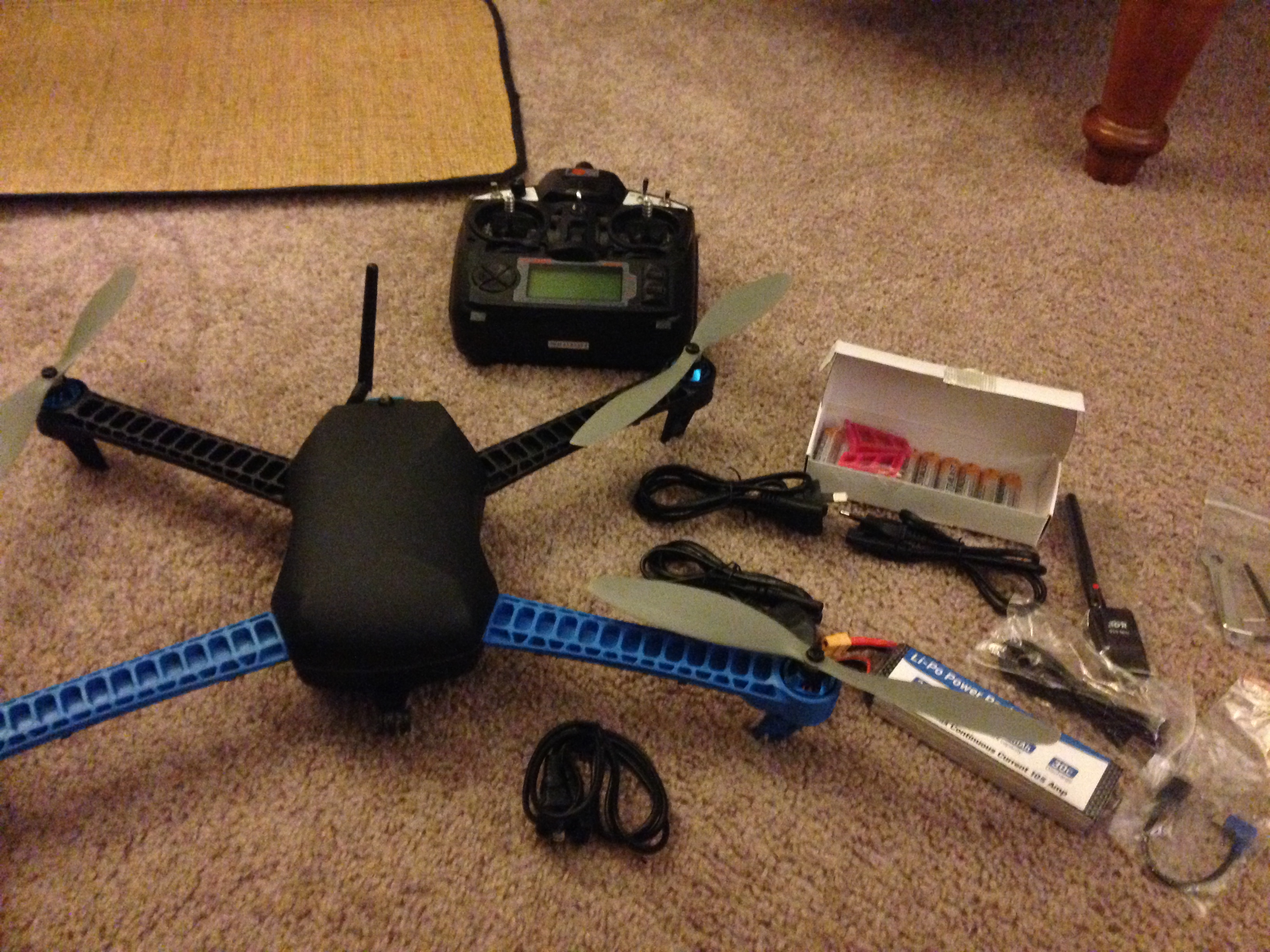
IRIS Package Includes: Copter, Battery and Charger, Tools, R/C, Accessories
After seeing a presentation by 3D Robotics last August, I was sold on their products based on their prices and track record. The IRIS is 3DR’s flagship product. The quadcopter comes with everything necessary, including a battery and R/C controller, in a convenient package. Technicians even pre-program the R/C with 5 different flight settings.
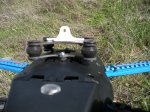
Vibrations or “jello” cause distortions and smearing
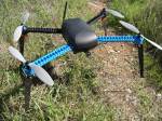
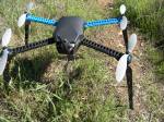
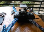
The other key component necessary was the camera and camera mount. I had an iPhone already, so the camera was taken care of. Configuring a mount though was a major challenge since nothing exists on the market for iPhones. Copters by nature produce high frequency vibrations and without the proper mount, the vibrations will bleed into your photos/video. This effect is commonly referred to as “jello.”
As I came to find out, the iPhone’s CMOS rolling shutter sensor is especially susceptible to jello. To fix this, I ordered a vibration dampening mount made for a DJI Phantom. To my surprise, the mounting screw locations matched the IRIS’ bottom vents perfectly! After finding some go pro mounts, extension legs, and clear iPhone case, I had pieced together a vibration free fixed iPhone 5s mount for the bottom of my IRIS (See gallery below).
Since installing the mount, the images from my iPhone are now about 90-95% jello free. More experiments are under way to improve image quality even more, but for now, I’m pretty satisfied with the results.
The 3DR IRIS is a lot of fun and an amazing UAS. So far I have been able to fly manually pretty well and have set up some successful autonomous flights. Mission Planner can be overwhelming to a novice, but I’m excited to unleash its capabilities. There are a number of features I’m looking forward to learning including:
Geofence
Battery monitor
Data logs
RC display errors
Applied Photogrammetry Using Drone Technology and the World's Most Popular Camera