For the optimist, the news of additional funding for UAS integration ensures confidence that the United States is determined to open the skies, sooner rather than later, to commercial drone operations. News, however, that congress is “uncertain when the FAA can integrate UAS into the Nation’s airspace” enables skeptics to roll their eyes at yet another hollow justification of the delays by the government.
Truth be told, “the government is trying to have it’s cake and eat it too.” It’s fantastic that congress recognizes the importance of UAS integration into the Nation’s airspace. But admitting that the FAA may be incapable of fulfilling its duties is does not exactly conjure up positive feelings for those waiting on the sidelines.
Below is an excerpt from 2nd session of the 113th Congress:
The FAA Modernization and Reform Act of 2012 directed the FAA to integrate UAS into the National Airspace System by 2015. However, it is uncertain when the FAA can integrate UAS into the Nation’s airspace and what will be required to achieve the goal. The lack of an overall framework for the new systems may be inhibiting progress on UAS integration. The Committee is concerned that the FAA may not be well positioned to manage effectively the introduction of UAS in the United States, particularly in light of a recent ruling by a National Transportation Safety Board (NTSB) administrative judge regarding the use of a small UAS for commercial purposes. Given these challenges, the Committee has provided an additional $3,000,000 in the Aviation Safety Activity to expedite the integration of UAS into commercial airspace.
I know cliches aren’t exactly the most professional ways of making a point, but the best thing I could say to end this post is:
Dear FAA and Congress….. Actions speak louder than words.
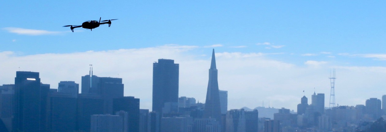
Team BlackSheep recently released a first person view (FPV) video from a UAS flying over the Burj Khalifa, the world’s tallest building in Dubia. That’s almost 2,800 ft folks.
The increasing potential of small UAS commercial applications continues to push the demand for rules and regulations to new heights. According to Aviation Week, the FAA is working to expedite COA exemptions for the agriculture, film making, pipeline/power-line inspection, and oil-and-gas inspection industries. For good reason, safety is touted as the number one reason that these industries are first in line for such exemptions. Jim Williams, the UAS integration office manager for the FAA, emphasized “exemptions will be for specific limited and low-risk operations.”
In true FAA fashion, however, Williams complicates matters by stating “there will still have to be a certified pilot with specific training for that type of aircraft. We can’t waive that.” So does this mean an individual with a certified pilot’s licence? If this is true, he is basically defining the requirements of the Special Airworthiness Certificate (SAC) which is already in place. In February, I challenged the FAA on the legitimacy of needing a certified pilot for sUAS operations. A justification was not given.
Maybe Williams is referring to a UAS specific pilot certification. Could it be that the FAA is taking the progressive approach of developing this certification in the very near future? This would be a breath of fresh air because it would help establish the beginning foundations of the regulation process.
I hate to sound like a pessimist, but my gut says that is wishful thinking.
I wanted to pass along an exciting event hosted by the American Society of Photogrammetry and Remote Sensing (ASPRS) Northern California Region! The UAS Technical Demonstration and Symposium will take place October 21-22 in Reno, Nevada. An abstract of the event is below:
The ASPRS Northern California Region is hosting a 2-day symposium on unmanned aircraft systems (UAS) in Reno, NV on October 21-22, 2014. The purpose of the event is to assemble academia, UAS developers, survey and mapping companies, government agencies, and UAS enthusiasts, to share information, showcase new technologies and demonstrate UAS systems in action (in flight). The event will be held at the Reno Stead Airport, an FAA-designated UAS test site, as well as at a symposium hotel in downtown Reno. The mission of the event is to advance knowledge and improve the understanding of UAS technologies and their safe and efficient introduction into our national airspace, government programs and business.
Information about the symposium and ASPRS can be found attheir website, or you can contact me and I will point you in the right direction.
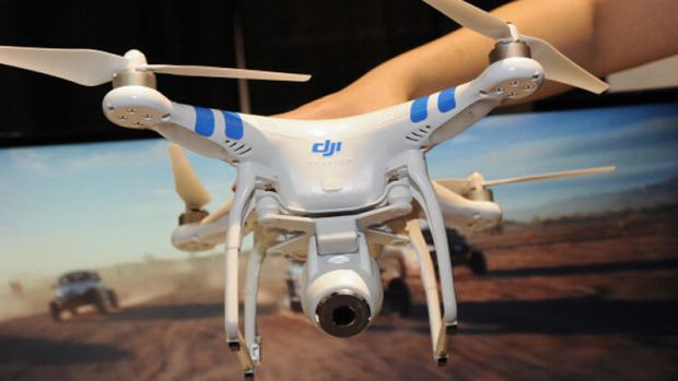
“She says her boyfriend noticed the blinking aircraft sitting in the middle of Fulton street on Saturday night, and decided to bring it in for a closer look.”
A drone, like this Phantom 2 model, was found Saturday on Fulton Street in San Francisco. (ROBYN BECK/AFP/Getty Images
A few weeks ago, “60 Minutes” dedicated an entire story titled Drones Over America highlighting the proliferation of drones in the civilian world. The juxtaposition of veteran Morley Safer (82) interacting with a technology so virgin yet relevant made for quite an entertaining program. Overall it was an excellent showcase of the technologies growing capabilities, and true to 60 Minutes form, it featured proponents and opponents from both sides of the coin.
Below are some highlights:
Domestic drones are poised to become a multibillion dollar industry, revolutionizing everything from crop management to package delivery.
For the moment, their barely regulated
We’re looking at the future, and whether you like it or not, the future is looking back at us.
Sophisticated as they are, an idiot can fly one.
Guinn: “Man, I’m not really too sure what I’m going to take aerial photos or video of, but that thing is really cool, and I want one.”
Toscano: “We build drones for the 4 D’s: dirty, dangerous, difficult, and dull missions.”
The common denominator in the world of most drones is the camera.
Cummings: “Using a drone for pictures is no different than using high-powered binoculars or a telephoto lens.”
Feinstein: “When does it become stalking? When does it invade privacy?”
Cummings: “It’s revolutionizing the aerospace industry in a way not seen in 25 years.”
When will a drone be at your front door? Time and technology will wait for no one.
The burgeoning emergence of highly-capable consumer cameras combined with affordable and ready-to-fly (RTF) sUAS has empowered anyone with an interest to become an aerial photographer. The addition of youtube, geotagging, smartphones, and social networks has created a vast network of aerial video and imagery, available to anyone with an internet connection. Drone Analyst posted a great article about the Democratization of Aerial Photography highlighting this phenomenon.
Enabled by the democratization, the applications of UAS are endless. Those that receive the most attention are listed below:
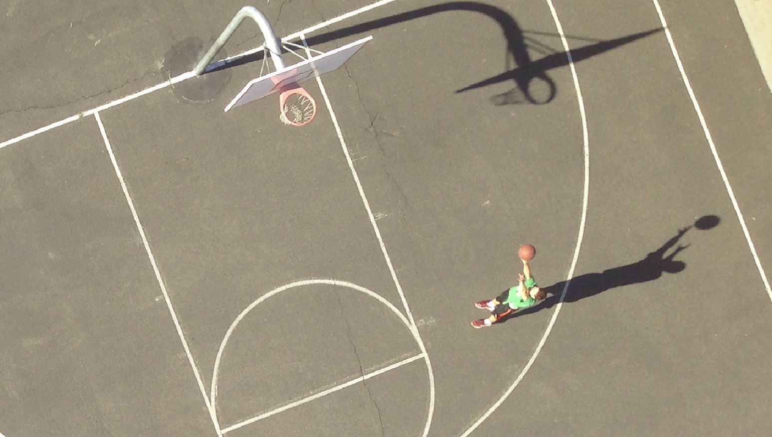
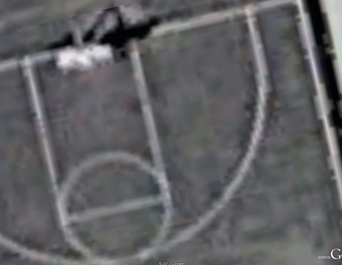
High Resolution Aerial Survey and Mapping
1 cm resolution image acquired w/iphone and UAS2.5 m? resolution taken from Google Earth
Being that I’ve been a photogrammetry and remote sensing professional for over 5 years, this area is of particular interest to me. The aerial survey industry has long relied on manned aircraft or satellites to acquire geospatial data. Professionals have a proven track record of manufacturing products with high levels of quality and accuracy. Three inch image resolution is the normal standard of high resolution imagery by most firms. Other sensors like LiDAR, synthetic aperture radar, and hyperspectural imagery are common acquisition platforms.
Small UAS have the potential to marginalize the current aerial survey and mapping industry. Their ability to fly low, cheap, and efficient could revolutionize the way geospatial data is collected in the next 2-5 years. Obtaining imagery with low-cost cameras/sensors at centimeter resolution is an absolute a reality at this time. What is lacking, however, is the proven quality and accuracy of these products compared to traditional industry counterparts.
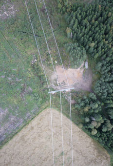
Pipelines and Power Lines
Utility companies are common clients for aerial survey firms. Corridor mapping is highly effective at collecting an inventory of utility infrastructure. SUAS are perfect for this application because of their ability to collect high-resolution imagery or LiDAR in only a few flight lines.
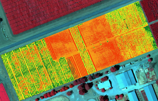
Precision Agriculture
There is a lot of buzz around using sUAS for vegetation analysis. This is achieved by acquiring imagery in the near-infrared (NIR) spectrum and then applying the normalized difference vegetation index (NDVI). Virtually any point-and-shoot can be converted to sense NIR (although quality is still unproven). The thinking around the UAS community is that agriculture will be the biggest market for NIR equipped sUAS. NDVI maps of ag fields would empower farmers to see exactly which fields are healthy and which are not. The Daily Beast wrote a great article about how drones could soon be ubiquitous to American farms.
One of the most obvious and controversial applications is journalism. It’s bad enough that the paparazzi apologetically harass celebrities on foot. Empowering them to shoot above someones private property is a whole different story. These journalism tactics strike the fear of “big brother” in many Americans.
There have been positive results to using drones for journalism, however. UAS have allowed film makers to obtain amazing aerial shots for movies, TV shows, and documentaries. The makers of the “Flying-CAM Sarah” were recently honored by the Academy of Motion Pictures for it’s work in movies like “Skyfall,” “Oblivion,” and “Prisoners.”
Site Inspection
Rather than higher an expensive helicopter or manned aircraft, construction managers are increasingly turning to UAS technology. They are safer, cheaper, and provide all of the information from a bird’s-eye-view that a site manager would want to know. And they enable managers to easily monitor the progress of a site throughout the project’s life cycle.
Quarry’s and landfills also benefit greatly from sUAS. 3D models can provide an accurate inventory of stockpiles and calculations of material volumes are easily attainable using sUAS acquired imagery.
Real Estate
Real estate is quickly becoming one of the most widely reported applications of UAS. “One 57,” Manhattan’s newest state-of-the-art condominium high-rise, used UAS as an incredibly effective marketing tool by capturing what views would look like on different floors. This enabled potential customers the opportunity to “see” what their view would be before the construction was even finished.
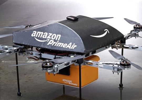
One of my favorite videos is from Domino’s in the U.K. of a drone delivering a pizza. The concept seemed far fetched initially, but in a matter months, there were videos of other companies jumping on the drone delivery bandwagon.
Amazon made the most publicized announcement when it aired a “60 Minutes” piece about future UAS delivery plans. Like many new ideas, there has been criticism and skepticism, but in the long run, I believe Amazon’s “Prime Air” will revolution parcel delivery.
Applied Photogrammetry Using Drone Technology and the World's Most Popular Camera